The hike at a glance.
- Starting area
- La Laura
- Reference distance
- 3.3 km
- Elevation gain
- 450 m
- Reference duration
- About 4 hours
- Summit elevation
- 820 m
- Difficulty
- Technical climb
Distance, ascent and duration describe the guided itinerary cited by Hiking Mauritius. Timing varies with the group, weather and time on ropes. Hiking Mauritius
A guide is required for the summit.
Arrange a professional guide experienced in this technical ascent. The final rocky section and summit boulder require roped climbing and a protected descent. A GPX file shows a line on a map; it does not replace the guide or the climbing equipment.
guide@pieterboth.orgMeet your guide at La Laura
The reference itinerary meets at La Laura Football Pitch, in the Moka region. Confirm the exact meeting pin, start time and transport arrangements by email before travelling. Your guide will check the group, fit equipment and explain the day’s objective.
Climb through the forest
The lower approach takes you through tropical vegetation onto increasingly steep ground. Expect an uphill effort with rocky sections rather than a maintained promenade. Footwear with reliable grip matters, and wet rock can change the day’s plan. Keep enough energy for the descent.
Reach the shoulder and reassess
The shoulder sits below the upper summit formation. It is the point to discuss the exposed climb ahead, your comfort with heights and the conditions with your guide. Stopping here is a different outing from reaching the boulder’s top; agree your objective before setting off.
Continue on ropes to the summit boulder
Beyond the approach, the route becomes exposed climbing. Your guide manages the rope system, protection and supervision. You will use a harness and helmet for the upper section. Reaching the top of the distinctive boulder is the technical summit objective, not simply the last few walking steps.
Descend under your guide’s supervision
The return is part of the technical climb. Keep the same supervision for the steep upper ground and the roped descent, then retrace the agreed approach to La Laura. Do not plan an inflexible onward appointment around the four-hour reference duration.
Pack for the whole outing
Bring grippy hiking shoes, drinking water, a snack, sun protection and a wind or rain layer. Confirm which climbing equipment your guide supplies. Describe your experience and comfort with exposure when enquiring, so the guide can assess whether this outing fits you.
GPX files and route references
Choose the track that matches your planned outing and review it with your guide. These historical records do not confirm current route conditions.
Partial approach GPX
Two tracks recorded in 2008 cover the mountain approach ending before the shoulder and the road from St Pierre to La Laura. The file does not include the final roped summit climb.
Download the approach GPXSummit-route GPX
This route describes the summit climb. Elevation and map-position inaccuracies are reported near the summit. Review the track with your guide. Account access is required to export the GPX.
Open the summit route and GPXFind the La Laura area
Use the area map to orient yourself before travelling. Confirm the exact meeting pin with your guide.
Open the area map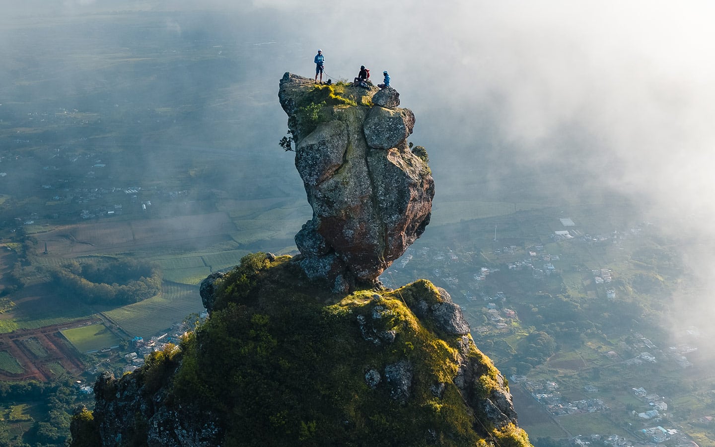
The questions worth asking.
What is the difference between the hike and the summit?
An approach walk, the protected upper climb and the top of the summit boulder are different objectives. Agree the exact endpoint of your outing before comparing descriptions or timings.
The Pieter Both hike from La LauraHow long does Pieter Both take?
The guided itinerary cited by Hiking Mauritius allows about four hours for 3.3 km with 450 m of ascent. Your guide confirms the timing for your group. Allow for equipment checks, the roped summit section and the descent, as well as travel to La Laura.
The Pieter Both hike from La LauraWhere does the Pieter Both hike start?
The reference guided itinerary meets at La Laura Football Pitch, in the Moka region. Email guide@pieterboth.org to confirm your exact meeting pin, date and start time before travelling.
The Pieter Both hike from La LauraDo I need a guide for Pieter Both?
A guide is required for the summit ascent described here. The final section involves exposed roped climbing, followed by a protected descent. Arrange a professional guide with experience of this route at guide@pieterboth.org.
What reaching the summit really meansAre there technical climbing sections?
Yes, the upper objective is described as technical. Confirm the equipment and supervision for the particular itinerary. Do not rely on a claim that an existing rope, chain or anchor makes an independent attempt suitable.
What reaching the summit really meansCan I download a Pieter Both GPX?
Yes. The guide links to a downloadable historical approach GPX and to a summit-route GPX export. The approach file stops before the shoulder and includes a separate road track. Neither replaces a guide for the roped summit climb.
The Pieter Both hike from La LauraIs Pieter Both open today?
Open. Pieter Both access reported open by the site owner on 14 October 2026. Confirm your intended outing and weather conditions before departure.. Valid until 17 October 2026 at 16:05 (Mauritius).
Pieter Both access and conditionsPlan your climb with a guide.
Email your preferred date, group size and hiking or climbing experience. Ask about the meeting point, equipment, route and conditions for your outing.
guide@pieterboth.orgSources and evidence
The sources below support background information. They do not confirm today’s access or conditions.
- Mauritius Tourism Promotion Authority
Mountain identity, Moka Range, La Laura and the recommendation to use suitable equipment and a local professional guide. This is not a current access notice.
Source review - Hiking Mauritius
Technical overview and cited guided itinerary of 3.3 km, 450 m ascent and about four hours. Scope is programme-specific. Access is maintained separately from our owner report.
Source review - Published guided-climb itinerary
Distance, ascent, duration, La Laura Football Pitch and roped final section. No price, inclusion or availability is offered on this guide.
Source review